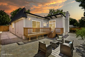


Neighborhoods: Willow Glen, Cambrian, Rose Garden, Berryessa, Evergreen, Almaden Valley
Housing: Detached homes, townhouses, and condos
Schools to research: San José Unified, Cambrian, Berryessa Union, and other districts by address
Transit/airport: Caltrain at Diridon, VTA, Berryessa BART; SJC
Shopping & recreation: Santana Row, Municipal Rose Garden, Almaden Lake
Key consideration: Submarket pricing, condition, school assignments
Healthcare and Hospitals: Santa Clara Valley Medical Center and Good Samaritan Hospital are examples of hospitals in San Jose.
What makes San Jose Distinctive: Neighborhood differences are unusually large; compare Willow Glen, Cambrian, Berryessa, Almaden and Evergreen on their own terms.
Before buying: Check permits and inspections for additions or conversions; compare highway, airport and rail noise by address.
Practical address-specific checklist: Visit during commuting hours and at night; check grocery and Costco travel routes, healthcare network access, parks, local noise, permits, public hazard maps, and total monthly ownership costs. This is a research checklist—not a claim that every block is the same.
Activities, attractions & everyday lifestyle: Walk Willow Glen’s Lincoln Avenue, visit San Pedro Square, explore the Municipal Rose Garden, attend an event at SAP Center, or take family trips to Happy Hollow and Almaden Lake. Different districts create very different weekend routines. Visit San Jose neighborhood guide and the City of San José transportation overview.
Homebuying analysis & local housing trends: “San Jose housing market” is not one single neighborhood market. Evaluate Cambrian ranch houses, Willow Glen character homes, Downtown condos, Berryessa townhomes, and larger Almaden properties in separate comparable-sale groups. Before offering, compare actual interior condition, parcel utility, permitted improvements, nearby inventory, and the insurance quote. San Jose is especially useful when buyers want flexibility among housing types without leaving the South Bay.


Neighborhoods: Rivermark, Old Quad, Central Park area
Housing: Established detached homes and newer townhomes
Schools to research: Santa Clara Unified and other districts by address
Transit / airport: Santa Clara/Lawrence Caltrain, VTA; SJC
Shopping & recreation: Santa Clara University, Central Park, Levi’s Stadium
Key consideration: HOA costs, event traffic, older systems
Healthcare and Hospitals: Kaiser Permanente Santa Clara Medical Center is located in the city.
What makes Santa Clara Distinctive: Central location and Santa Clara University distinguish this city from neighboring markets.
Before buying: Check special assessments, ownership/utility details, HOA financials and event-day traffic around major venues.
Practical address-specific checklist: Visit during commuting hours and at night; check grocery and Costco travel routes, healthcare network access, parks, local noise, permits, public hazard maps, and total monthly ownership costs. This is a research checklist—not a claim that every block is the same.
Activities, attractions & everyday lifestyle: Visit the Mission Santa Clara campus area, enjoy Central Park, compare Rivermark’s planned-community amenities, and check the schedule of events at Levi’s Stadium. The Santa Clara location also offers access to the regional shops near Stevens Creek Boulevard.
Homebuying analysis & local housing trends: Compare established Old Quad houses with Rivermark-area developments rather than assuming their ownership costs are interchangeable. Review HOA disclosures, potential assessments, noise on event days, and city-specific utility arrangements. Buyers often choose Santa Clara for central employment access, but the best block depends on a specific commute and desired lot or home format.


Neighborhoods: Cherry Chase, Lakewood, Heritage District, Birdland
Housing: Ranch homes, townhomes and condos
Schools to research: Sunnyvale and neighboring districts; confirm address
Transit / airport: Sunnyvale/Lawrence Caltrain; SJC
Shopping & recreation: Historic Murphy Avenue, Baylands Park
Key consideration: Lot size, higher premiums in some neighborhoods
Healthcare and Hospitals: Medical offices and regional hospitals are accessible across Sunnyvale and adjacent Mountain View/Santa Clara; confirm your provider network.
What makes Sunnyvale Distinctive: Murphy Avenue and two Caltrain stations make location within Sunnyvale especially important.
Before buying: Check Caltrain station access, lot size, neighborhood boundaries and renovation permits.
Practical address-specific checklist: Visit during commuting hours and at night; check grocery and Costco travel routes, healthcare network access, parks, local noise, permits, public hazard maps, and total monthly ownership costs. This is a research checklist—not a claim that every block is the same.
Activities, attractions & everyday lifestyle: Spend a Saturday on Murphy Avenue, explore Baylands Park trails, and review how close a potential home is to Sunnyvale or Lawrence Caltrain. Nearby shopping and recreation opportunities change considerably between north and south Sunnyvale.
Homebuying analysis & local housing trends: A Sunnyvale real estate comparison should separate south-side detached homes, Lakewood housing and condominium or townhome sales by neighborhood. Tree-lined streets and residential lot sizes can influence value as much as square footage. Check nearby transit noise, renovation permits and older plumbing/electrical systems when applicable.


Neighborhoods: Monta Vista, Garden Gate, Rancho Rinconada
Housing: Detached houses and renovated premium homes
Schools to research: Cupertino Union and Fremont Union High in relevant areas
Transit / airport: I-280, CA-85, buses; SJC
Shopping & recreation: Apple Park area, Memorial Park, Main Street Cupertino
Key consideration: School-boundary verification, renovation costs
Healthcare and Hospitals: Regional medical centers in Santa Clara and Mountain View serve the area; confirm your provider network and travel time.
What makes Cupertino Distinctive: Apple Park, western Silicon Valley location and proximity to foothill trails are distinguishing features.
Before buying: Validate school assignment directly; examine older foundations, renovations, lot usability and the commute without rail.
Practical address-specific checklist: Visit during commuting hours and at night; check grocery and Costco travel routes, healthcare network access, parks, local noise, permits, public hazard maps, and total monthly ownership costs. This is a research checklist—not a claim that every block is the same.
Activities, attractions & everyday lifestyle: Explore Memorial Park, visit Main Street Cupertino, enjoy the Apple Park Visitor Center and try trails near Rancho San Antonio. These features help buyers picture everyday activities beyond the house itself.
Homebuying analysis & local housing trends: Cupertino home prices can be heavily influenced by lot characteristics, remodeling potential, location and buyer demand for particular school boundaries. Confirm assignments with districts rather than using online listing claims. Also evaluate I-280/CA-85 access, renovation constraints and the absence of a Caltrain station in the city.


Neighborhoods: Old Mountain View, Cuesta Park, Whisman
Housing: Detached homes, townhouses and condos
Schools to research: Mountain View Whisman, Mountain View–Los Altos in relevant areas
Transit / airport: Caltrain, VTA; SJC and SFO
Shopping & recreation: Castro Street, Shoreline Lake, Computer History Museum
Key consideration: Smaller lots and premium-location costs
Healthcare and Hospitals: El Camino Health operates its Mountain View hospital.
What makes Mountain View Distinctive: Castro Street, Caltrain and Shoreline create a combination of downtown and bayfront amenities.
Before buying: Check flight-path noise where relevant, flood/drainage conditions in bayside areas, and condo HOA reserves.
Practical address-specific checklist: Visit during commuting hours and at night; check grocery and Costco travel routes, healthcare network access, parks, local noise, permits, public hazard maps, and total monthly ownership costs. This is a research checklist—not a claim that every block is the same.
Activities, attractions & everyday lifestyle: Walk Castro Street for restaurants and events, visit the Computer History Museum, and spend time at Shoreline Lake or Bay Trail paths. Test the actual walk or bike route to Caltrain rather than relying on the city name.
Homebuying analysis & local housing trends: Mountain View homes for sale include small-lot detached houses, high-density townhomes and condos. Downtown proximity can carry a different premium than bayside location or quieter residential streets. For condos, examine HOA reserves and insurance; for older homes, review permits, sewer, drainage and remodel scope.


Neighborhoods: Midtown, Barron Park, Professorville, Crescent Park
Housing: Established detached homes and condos
Schools to research: Palo Alto Unified; verify current assignments
Transit / airport: Palo Alto/California Avenue Caltrain; SFO/SJC
Shopping & recreation: Stanford, University Avenue, Baylands Preserve
Key consideration: High prices, older-house maintenance
Healthcare and Hospitals: Stanford Health Care and Lucile Packard Children’s Hospital Stanford are nearby medical resources.
What makes Palo Alto Distinctive: Stanford University, California Avenue and University Avenue create distinct employment and downtown anchors.
Before buying: Evaluate seismic retrofits, heritage-property requirements if applicable, lot premiums and renovation scope.
Practical address-specific checklist: Visit during commuting hours and at night; check grocery and Costco travel routes, healthcare network access, parks, local noise, permits, public hazard maps, and total monthly ownership costs. This is a research checklist—not a claim that every block is the same.
Activities, attractions & everyday lifestyle: Compare University Avenue with California Avenue’s business district, explore Stanford-area cultural amenities, and walk through the Baylands Nature Preserve. Each area delivers a different rhythm of daily life.
Homebuying analysis & local housing trends: Palo Alto’s median price can move considerably when a small number of high-value properties close. Review property-level comparable sales, lot usability, architecture or preservation constraints and financing rather than treating the median as an asking-price guide. In older homes, investigate foundation, seismic work, utilities and permitted additions.


Neighborhoods: Parktown, Midtown, foothill neighborhoods
Housing: Detached houses, condos and townhomes
Schools to research: Milpitas Unified
Transit / airport: Milpitas BART, VTA, I-680, I-880; SJC
Shopping & recreation: Ed R. Levin Park, Great Mall
Key consideration: Highway noise, HOA fees, location-specific risks
Healthcare and Hospitals: Kaiser Permanente Santa Clara and nearby San Jose medical centers are regional healthcare options.
What makes Milpitas Distinctive: Its BART/VTA interchange and Ed R. Levin foothill park access are valuable differentiators.
Before buying: Check freeway/rail noise, development-area HOAs, special assessments and local flood/fire maps.
Practical address-specific checklist: Visit during commuting hours and at night; check grocery and Costco travel routes, healthcare network access, parks, local noise, permits, public hazard maps, and total monthly ownership costs. This is a research checklist—not a claim that every block is the same.
Activities, attractions & everyday lifestyle: Hike Ed R. Levin County Park, use the Great Mall retail district and test a trip through Milpitas BART/VTA Transit Center. Distances to the transit hub vary greatly between neighborhoods.
Homebuying analysis & local housing trends: Milpitas properties should be compared by older detached-home neighborhoods versus newer planned townhome and condo developments. HOA dues, special assessments, freeway exposure and construction quality can materially change the monthly picture. Buyers often compare Milpitas with Fremont for a balance of commute flexibility and housing type.


Neighborhoods: Downtown, San Tomas, Pruneyard area
Housing: Older detached houses, condos and townhomes
Schools to research: Campbell-area districts vary by address
Transit / airport: VTA light rail, CA-17, CA-85; SJC
Shopping & recreation: Downtown Campbell, Pruneyard, Los Gatos Creek Trail
Key consideration: Parking, lot sizes, older-home condition
Healthcare and Hospitals: Good Samaritan Hospital in San Jose is a nearby regional hospital example.
What makes Campbell Distinctive: Downtown Campbell, a regular farmers market and Los Gatos Creek Trail reinforce its walkable identity.
Before buying: Check parking, older-property condition, school boundaries and proximity to major roads.
Practical address-specific checklist: Visit during commuting hours and at night; check grocery and Costco travel routes, healthcare network access, parks, local noise, permits, public hazard maps, and total monthly ownership costs. This is a research checklist—not a claim that every block is the same.
Activities, attractions & everyday lifestyle: Enjoy the downtown farmers market, Pruneyard restaurants and Los Gatos Creek Trail. The walkability benefit is greatest when a specific home is genuinely close to your preferred places.
Homebuying analysis & local housing trends: Campbell offers both charming established houses and attached homes. A property near a lively downtown street can differ greatly from one on a quieter residential block. Check parking, sound, lot area, school boundaries and any older-property renovation needs.


Neighborhoods: Downtown, Blossom Hill, foothill areas
Housing: Established and premium detached homes
Schools to research: Applicable Los Gatos-area districts
Transit / airport: CA-17/CA-85; SJC
Shopping & recreation: Vasona Lake, Los Gatos Creek Trail
Key consideration: Slope, wildfire insurance, purchase premiums
Healthcare and Hospitals: El Camino Health’s Los Gatos hospital is a local healthcare resource.
What makes Los Gatos Distinctive: Downtown Los Gatos, Vasona Lake and Santa Cruz Mountains access offer a distinct lifestyle.
Before buying: Review slopes, drainage, wildfire insurance, retaining walls and road access for hillside homes.
Practical address-specific checklist: Visit during commuting hours and at night; check grocery and Costco travel routes, healthcare network access, parks, local noise, permits, public hazard maps, and total monthly ownership costs. This is a research checklist—not a claim that every block is the same.
Activities, attractions & everyday lifestyle: Spend time in the historic downtown, visit Vasona Lake County Park and explore nearby Santa Cruz Mountains trails. Buyers interested in weekend outdoor activities may value these amenities.
Homebuying analysis & local housing trends: Los Gatos real estate ranges from village-area houses to hillside properties with greater slope and access considerations. Verify insurance availability, retaining walls, drainage and road access early. Consider how mountain routes behave during commute hours and storm conditions.


Neighborhoods: Saratoga Village and residential foothills
Housing: Premium homes, larger lots in some areas
Schools to research: Multiple districts depending on exact address
Transit / airport: CA-85, I-280 access; SJC
Shopping & recreation: Hakone Gardens, Montalvo Arts Center
Key consideration: Land maintenance, insurance, pricing
Healthcare and Hospitals: Hospital services are available in surrounding communities including Los Gatos and Santa Clara; verify needs and access.
What makes Saratoga Distinctive: Hakone Gardens, Montalvo Arts Center and Saratoga Village make the area distinctive.
Before buying: For larger or foothill parcels, verify trees, grading, water/sewer arrangements, insurance and maintenance.
Practical address-specific checklist: Visit during commuting hours and at night; check grocery and Costco travel routes, healthcare network access, parks, local noise, permits, public hazard maps, and total monthly ownership costs. This is a research checklist—not a claim that every block is the same.
Activities, attractions & everyday lifestyle: Visit Hakone Estate and Gardens, explore Montalvo Arts Center, and stop at Saratoga Village restaurants and shops. The city’s cultural and foothill features distinguish it from denser Silicon Valley centers.
Homebuying analysis & local housing trends: Compare homes by land usability and maintenance as well as interior square footage. Some large lots involve more tree care, drainage responsibilities or wildfire exposure. Confirm school boundaries, renovation feasibility and access to services for any specific property.


Neighborhoods: Downtown, Paradise Valley, west-side areas
Housing: Detached houses and townhouses
Schools to research: Morgan Hill Unified
Transit / airport: US-101, limited Caltrain; SJC
Shopping & recreation: Downtown Morgan Hill, trails and parks
Key consideration: Northbound commute
Healthcare and Hospitals: Regional healthcare services are available in the South County area; confirm current hospital and specialist availability.
What makes Morgan Hill Distinctive: El Toro, downtown Morgan Hill and access to Anderson Lake-area recreation stand out.
Before buying: Test peak-hour US-101 commute; examine fire exposure, newer-home assessments and lot conditions.
Practical address-specific checklist: Visit during commuting hours and at night; check grocery and Costco travel routes, healthcare network access, parks, local noise, permits, public hazard maps, and total monthly ownership costs. This is a research checklist—not a claim that every block is the same.
Activities, attractions & everyday lifestyle: Explore downtown restaurants and events, the El Toro landmark, walking trails and nearby reservoirs or parks where access is open. The area may appeal to buyers who enjoy a smaller-city center and outdoor activities.
Homebuying analysis & local housing trends: Morgan Hill homes may offer different outdoor-space options than communities farther north, but the tradeoff is often travel time. Test US-101 at your actual commute hour; compare special taxes in newer developments, insurance, energy costs and housing age.


Neighborhoods: Downtown, northwest and southwest areas
Housing: Detached houses and townhomes
Schools to research: Gilroy Unified
Transit / airport: US-101, limited Caltrain; SJC farther away
Shopping & recreation: Gilroy Gardens, outlets
Key consideration: Commute, property-specific maintenance
Healthcare and Hospitals: St. Louise Regional Hospital serves the South County area; verify current service availability.
What makes Gilroy Distinctive: Gilroy Gardens, outlet shopping, agriculture and the Santa Clara County southern gateway set it apart.
Before buying: Review commuting, water, agricultural adjacency, flood zones and permitted improvements.
Practical address-specific checklist: Visit during commuting hours and at night; check grocery and Costco travel routes, healthcare network access, parks, local noise, permits, public hazard maps, and total monthly ownership costs. This is a research checklist—not a claim that every block is the same.
Activities, attractions & everyday lifestyle: Visit Gilroy Gardens, the outlet retail area, local parks and agricultural-themed events. A south-county lifestyle may feel very different from central Silicon Valley.
Homebuying analysis & local housing trends: Gilroy houses for sale can include established neighborhoods, newer subdivisions and properties with rural characteristics. Before buying, compare commute tolerance, utilities, agricultural adjacency, permitted additions and local drainage. Avoid assuming a larger property is cheaper to maintain.


Neighborhoods: The Willows, Downtown, Belle Haven
Housing: Detached houses, condos and townhomes
Schools to research: Different districts by address
Transit / airport: Caltrain, US-101; SFO/SJC
Shopping & recreation: Santa Cruz Avenue, parks
Key consideration: Cost, school assignment, property condition
Healthcare and Hospitals: Stanford Health Care and Peninsula medical offices are regional healthcare options.
What makes Menlo Park Distinctive: Santa Cruz Avenue downtown and Stanford-area employment are distinctive features.
Before buying: Review school district overlap, flood exposure in eastern areas and old-home infrastructure.
Practical address-specific checklist: Visit during commuting hours and at night; check grocery and Costco travel routes, healthcare network access, parks, local noise, permits, public hazard maps, and total monthly ownership costs. This is a research checklist—not a claim that every block is the same.
Activities, attractions & everyday lifestyle: Walk Santa Cruz Avenue and neighborhood parks, and explore nearby Stanford-area amenities. Compare trips to Caltrain or the Dumbarton corridor from individual streets.
Homebuying analysis & local housing trends: Menlo Park markets differ substantially among downtown, Willows and Belle Haven areas. Look beyond the citywide median to comparable housing types, lot characteristics and school boundaries; proximity to major employment locations may affect buyer demand.
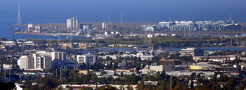


Neighborhoods: Mount Carmel, Friendly Acres, Redwood Shores
Housing: Mixed detached homes, condos and townhomes
Schools to research: Redwood City School District/Sequoia Union High where applicable
Transit / airport: Caltrain, US-101, I-280; SFO
Shopping & recreation: Courthouse Square, waterfront recreation
Key consideration: Flood exposure in applicable locations
Healthcare and Hospitals: Sequoia Hospital is a local hospital example.
What makes Redwood City Distinctive: Courthouse Square and the downtown Caltrain area distinguish Redwood City.
Before buying: Redwood Shores/bayside flood risk differs from inland/hillside issues; verify by parcel.
Practical address-specific checklist: Visit during commuting hours and at night; check grocery and Costco travel routes, healthcare network access, parks, local noise, permits, public hazard maps, and total monthly ownership costs. This is a research checklist—not a claim that every block is the same.
Activities, attractions & everyday lifestyle: Attend Courthouse Square events, browse downtown restaurants and enjoy Bay Trail or Redwood Shores waterfront paths. Downtown access and bayside settings offer different experiences.
Homebuying analysis & local housing trends: Redwood City condos and single-family neighborhoods occupy distinct price bands. Check flood exposure for bayside locations, property age, HOA insurance and the realistic walk to Caltrain. Compare Redwood Shores with central Redwood City as separate submarkets.


Neighborhoods: Downtown, White Oaks, hillside areas
Housing: Detached homes and townhomes
Schools to research: San Carlos and Sequoia districts in relevant areas
Transit / airport: Caltrain, US-101, I-280; SFO
Shopping & recreation: Laurel Street, local trails
Key consideration: Hillside drainage and condition
Healthcare and Hospitals: Sequoia Hospital in neighboring Redwood City is a nearby healthcare resource.
What makes San Carlos Distinctive: Laurel Street, Caltrain and access to the Peninsula hills are major draws.
Before buying: Hillside lots need drainage and foundation review; check proximity to the local airport.
Practical address-specific checklist: Visit during commuting hours and at night; check grocery and Costco travel routes, healthcare network access, parks, local noise, permits, public hazard maps, and total monthly ownership costs. This is a research checklist—not a claim that every block is the same.
Activities, attractions & everyday lifestyle: Enjoy Laurel Street cafes, nearby parks and local trails, and use Caltrain where convenient. Hilltop and downtown homes may involve different daily travel patterns.
Homebuying analysis & local housing trends: San Carlos housing conditions vary with slope, street access and building age. Investigate drainage, retaining walls and the actual distance to transit. Compare detached homes separately from smaller condos or townhomes.


Neighborhoods: Baywood, Beresford Park, North Central
Housing: Detached homes, condos and townhomes
Schools to research: San Mateo–Foster City, San Mateo Union High
Transit / airport: Caltrain, CA-92; SFO
Shopping & recreation: Central Park, Coyote Point
Key consideration: Older homes, flood exposure by address
Healthcare and Hospitals: San Mateo-area hospitals and clinics provide healthcare options; check actual provider availability.
What makes San Mateo Distinctive: Central Park, downtown and Coyote Point give the city varied neighborhood settings.
Before buying: Investigate older foundations, parking, train noise and flood/drainage depending on address.
Practical address-specific checklist: Visit during commuting hours and at night; check grocery and Costco travel routes, healthcare network access, parks, local noise, permits, public hazard maps, and total monthly ownership costs. This is a research checklist—not a claim that every block is the same.
Activities, attractions & everyday lifestyle: Walk downtown San Mateo, visit Central Park’s Japanese Garden, explore Coyote Point and the Bay Trail. The choice between west-side and bayside neighborhoods changes recreation and commute patterns.
Homebuying analysis & local housing trends: When comparing San Mateo homes for sale, separate Baywood, Beresford and North Central price ranges. Check building systems, flood mapping, insurance and access to Caltrain or CA-92. Property condition often matters as much as citywide demand.


Neighborhoods: Residential lagoon districts
Housing: Detached homes, condos and townhomes
Schools to research: San Mateo–Foster City, San Mateo Union High
Transit / airport: CA-92, buses; SFO
Shopping & recreation: Lagoons, waterfront paths
Key consideration: Flood protection, HOA, insurance
Healthcare and Hospitals: Regional healthcare is accessible in nearby San Mateo and Redwood City.
What makes Foster City Distinctive: Its manmade lagoons and bayside pathways are unusual among the featured cities.
Before buying: Review flood-control information, HOA documents, insurance, waterfront maintenance and property disclosures.
Practical address-specific checklist: Visit during commuting hours and at night; check grocery and Costco travel routes, healthcare network access, parks, local noise, permits, public hazard maps, and total monthly ownership costs. This is a research checklist—not a claim that every block is the same.
Activities, attractions & everyday lifestyle: Enjoy the city’s lagoons, waterside parks, walking trails and Bay Trail. The planned-community structure creates a recognizable waterfront recreational environment.
Homebuying analysis & local housing trends: Review lagoon proximity, flood protections, insurance, HOAs and waterfront-related maintenance carefully. A lagoon-facing property may command a premium but also have unique obligations; confirm what the HOA and owner maintain.


Neighborhoods: Downtown, Easton Addition, Burlingame Hills
Housing: Established detached homes and condos
Schools to research: Burlingame, San Mateo Union High
Transit / airport: Caltrain, US-101; SFO
Shopping & recreation: Burlingame Avenue, Washington Park
Key consideration: Premium prices, aircraft noise
Healthcare and Hospitals: Mills-Peninsula Medical Center in Burlingame is a major local healthcare facility.
What makes Burlingame Distinctive: Burlingame Avenue and close SFO access distinguish the city.
Before buying: Test aircraft noise at the exact address and review hillside or bayside property concerns.
Practical address-specific checklist: Visit during commuting hours and at night; check grocery and Costco travel routes, healthcare network access, parks, local noise, permits, public hazard maps, and total monthly ownership costs. This is a research checklist—not a claim that every block is the same.
Activities, attractions & everyday lifestyle: Stroll Burlingame Avenue and Broadway, use local parks, and review SFO connections. These downtown districts offer distinct shopping and dining experiences.
Homebuying analysis & local housing trends: Burlingame areas differ in hillside and flatland topography, aircraft noise and property age. Compare Easton Addition, downtown-adjacent and hillside homes separately. Verify parking, renovation condition and insurance costs.


Neighborhoods: Mission San Jose, Irvington, Niles, Ardenwood
Housing: Detached homes, townhomes, condos
Schools to research: Fremont Unified
Transit / airport: BART, I-880/I-680; OAK/SJC
Shopping & recreation: Mission Peak, Lake Elizabeth, historic Niles
Key consideration: Neighborhood premiums, actual commute
Healthcare and Hospitals: Washington Hospital in Fremont is a local healthcare resource.
What makes Fremont Distinctive: Mission Peak, historic Niles, BART and distinct residential districts create several lifestyle options.
Before buying: Check commute routes, active fault/seismic considerations, school boundaries and neighborhood-specific prices.
Practical address-specific checklist: Visit during commuting hours and at night; check grocery and Costco travel routes, healthcare network access, parks, local noise, permits, public hazard maps, and total monthly ownership costs. This is a research checklist—not a claim that every block is the same.
Activities, attractions & everyday lifestyle: Hike Mission Peak, visit Lake Elizabeth and discover historic Niles. Try different BART stations and driving routes to your workplace before settling on a neighborhood.
Homebuying analysis & local housing trends: Fremont homes for sale cannot be understood through a single city median: Mission San Jose, Niles, Ardenwood and Irvington differ in housing, price and access. Check school district assignment, fault and slope conditions in foothill locations, commute and property-specific inspection reports.


Neighborhoods: Central Newark, Lakeshore area
Housing: Detached homes, townhouses, condos
Schools to research: Newark Unified
Transit / airport: I-880, CA-84; OAK/SJC
Shopping & recreation: Retail centers, Don Edwards refuge nearby
Key consideration: Flood/drainage conditions by address
Healthcare and Hospitals: Washington Hospital in nearby Fremont is a regional healthcare option.
What makes Newark Distinctive: Proximity to Don Edwards refuge and major East Bay employment corridors helps differentiate Newark.
Before buying: Examine flood/drainage maps, shoreline conditions and proximity to industrial or transportation corridors.
Practical address-specific checklist: Visit during commuting hours and at night; check grocery and Costco travel routes, healthcare network access, parks, local noise, permits, public hazard maps, and total monthly ownership costs. This is a research checklist—not a claim that every block is the same.
Activities, attractions & everyday lifestyle: Explore Don Edwards San Francisco Bay National Wildlife Refuge, neighborhood parks and shopping around NewPark Mall. The city provides regional access toward Fremont and the Dumbarton corridor.
Homebuying analysis & local housing trends: Examine flood-zone maps and drainage history for bayside areas. Detached houses and newer developments can have different maintenance and HOA obligations; compare financing, travel routes and prices with nearby Fremont or Union City.


Neighborhoods: Decoto, Union Landing area
Housing: Established detached houses and condos
Schools to research: New Haven Unified
Transit / airport: Union City BART, I-880; OAK/SJC
Shopping & recreation: Quarry Lakes and retail
Key consideration: Traffic, home condition
Healthcare and Hospitals: Washington Hospital in nearby Fremont is a regional healthcare option.
What makes Union City Distinctive: Union City BART and Quarry Lakes provide transit and recreation anchors.
Before buying: Check noise and commute conditions, property condition and any HOA responsibilities.
Practical address-specific checklist: Visit during commuting hours and at night; check grocery and Costco travel routes, healthcare network access, parks, local noise, permits, public hazard maps, and total monthly ownership costs. This is a research checklist—not a claim that every block is the same.
Activities, attractions & everyday lifestyle: Explore Quarry Lakes, local community parks and transit-oriented areas around Union City BART. Check how the daily bus or drive to BART fits your routine.
Homebuying analysis & local housing trends: Union City housing includes older houses and attached communities with different price and HOA profiles. Compare the Decoto and Union Landing vicinity separately. Consider local traffic, roof and foundation age and noise near transport routes.


Neighborhoods: East Dublin, Dublin Ranch, West Dublin
Housing: Newer homes, condos and townhouses
Schools to research: Dublin Unified
Transit / airport: BART, I-580/I-680; OAK
Shopping & recreation: Emerald Glen Park
Key consideration: HOA and special taxes
Healthcare and Hospitals: Major healthcare options can be reached in the Tri-Valley; verify hospital/network fit.
What makes Dublin Distinctive: Two BART stations and extensive newer communities are its best-known practical features.
Before buying: Review Mello-Roos/special taxes, HOA budgets, new-construction warranties and school assignment.
Practical address-specific checklist: Visit during commuting hours and at night; check grocery and Costco travel routes, healthcare network access, parks, local noise, permits, public hazard maps, and total monthly ownership costs. This is a research checklist—not a claim that every block is the same.
Activities, attractions & everyday lifestyle: Visit Emerald Glen Park, City of Dublin recreational amenities and community shopping. Explore both East and West Dublin because their housing mixes differ.
Homebuying analysis & local housing trends: Newer development does not always mean lower monthly ownership costs. Review Mello-Roos or special taxes, HOA reserves and school-capacity information where applicable. For commute decisions, confirm actual access to Dublin/Pleasanton BART and I-580.


Neighborhoods: Downtown, Birdland, Vintage Hills
Housing: Detached houses, condos, townhouses
Schools to research: Pleasanton Unified
Transit / airport: BART nearby, ACE, I-680; OAK
Shopping & recreation: Downtown Pleasanton, Pleasanton Ridge
Key consideration: Silicon Valley commute
Healthcare and Hospitals: Stanford Health Care – ValleyCare in Pleasanton is a major local healthcare resource.
What makes Pleasanton Distinctive: Historic Main Street, Pleasanton Ridge and Tri-Valley employment define the area.
Before buying: Compare mature-neighborhood maintenance against newer-home HOA/assessment costs.
Practical address-specific checklist: Visit during commuting hours and at night; check grocery and Costco travel routes, healthcare network access, parks, local noise, permits, public hazard maps, and total monthly ownership costs. This is a research checklist—not a claim that every block is the same.
Activities, attractions & everyday lifestyle: Walk historic Main Street, visit Pleasanton Ridge trails and explore community parks or seasonal events. The established downtown offers a different feel from East Dublin’s newer planned communities.
Homebuying analysis & local housing trends: Compare historic center properties, Vintage Hills and other subdivisions by construction era and school attendance area. Valley heat, I-580/I-680 traffic and maintenance can affect long-term ownership satisfaction.


Neighborhoods: Downtown, South Livermore, Springtown
Housing: Detached homes and townhouses
Schools to research: Livermore Valley Joint Unified
Transit / airport: ACE, I-580; OAK
Shopping & recreation: Downtown, Del Valle, wineries
Key consideration: Summer heat, regional commute
Healthcare and Hospitals: Stanford Health Care – ValleyCare facilities serve the Tri-Valley region.
What makes Livermore Distinctive: Wineries, downtown Livermore, Del Valle and ACE rail give it a distinct identity.
Before buying: Test commute under normal traffic; review summer cooling costs and wildfire exposure by property.
Practical address-specific checklist: Visit during commuting hours and at night; check grocery and Costco travel routes, healthcare network access, parks, local noise, permits, public hazard maps, and total monthly ownership costs. This is a research checklist—not a claim that every block is the same.
Activities, attractions & everyday lifestyle: Explore First Street, Livermore Valley wineries, Del Valle Regional Park and downtown events. These recreational opportunities create a distinctive Tri-Valley lifestyle.
Homebuying analysis & local housing trends: Livermore properties vary among downtown, South Livermore and newer communities. Test a Silicon Valley commute, review summer energy costs, inspection findings and applicable special taxes. ACE rail service may be useful for some commuters, but check schedule and destination.


Neighborhoods: Rockridge, Temescal, Grand Lake, Montclair
Housing: Historic homes, townhouses and condos
Schools to research: Oakland Unified and other options
Transit / airport: BART, AC Transit; OAK
Shopping & recreation: Lake Merritt, dining and cultural venues
Key consideration: Seismic retrofits, neighborhood differences
Healthcare and Hospitals: Highland Hospital and other major Oakland providers serve the area; confirm specialties and networks.
What makes Oakland Distinctive: Lake Merritt, Rockridge/Temescal urban amenities, arts and BART are major differentiators.
Before buying: Evaluate seismic retrofits, older-building systems, hills fire zones and block-by-block transport needs.
Practical address-specific checklist: Visit during commuting hours and at night; check grocery and Costco travel routes, healthcare network access, parks, local noise, permits, public hazard maps, and total monthly ownership costs. This is a research checklist—not a claim that every block is the same.
Activities, attractions & everyday lifestyle: Spend time at Lake Merritt, explore Rockridge or Temescal restaurants, and visit regional parks and cultural venues. Neighborhood experiences can change substantially over short distances.
Homebuying analysis & local housing trends: Oakland condos, craftsman houses and hillside homes deserve separate valuation approaches. Pay particular attention to insurance, seismic retrofits, older sewer and electrical systems, local assessments and street-specific conditions. Verify permit history and disclosures.


Neighborhoods: North Berkeley, Elmwood, West Berkeley
Housing: Historic homes and condos
Schools to research: Berkeley Unified
Transit / airport: BART, AC Transit; OAK
Shopping & recreation: UC Berkeley, Tilden Regional Park
Key consideration: Older systems, hillsides and local regulations
Healthcare and Hospitals: Alta Bates Summit Medical Center and other regional providers are healthcare options.
What makes Berkeley Distinctive: UC Berkeley, the Gourmet Ghetto area and Tilden Park stand out.
Before buying: Review seismic risks, older structures, hillside wildfire exposure and applicable local ordinances.
Practical address-specific checklist: Visit during commuting hours and at night; check grocery and Costco travel routes, healthcare network access, parks, local noise, permits, public hazard maps, and total monthly ownership costs. This is a research checklist—not a claim that every block is the same.
Activities, attractions & everyday lifestyle: Explore the University of California campus, downtown food and arts, Tilden Regional Park and neighborhood shopping in Elmwood or North Berkeley.
Homebuying analysis & local housing trends: Berkeley’s older building stock and hillside locations make condition and seismic risk important. Review the rules for any rental or multi-unit property with qualified counsel and city sources. Consider BART access, stairs and slope, and renovation restrictions.


Neighborhoods: Gale Ranch, Windemere, Twin Creeks
Housing: Detached houses and townhouses
Schools to research: San Ramon Valley Unified
Transit / airport: I-680, BART bus links; OAK
Shopping & recreation: City Center Bishop Ranch, Central Park
Key consideration: HOA, special taxes, drive time
Healthcare and Hospitals: San Ramon Regional Medical Center is a local healthcare resource.
What makes San Ramon Distinctive: City Center Bishop Ranch, extensive parks and master-planned districts are signature features.
Before buying: Check the difference between bus-to-BART versus a true local BART station; verify HOA and assessments.
Practical address-specific checklist: Visit during commuting hours and at night; check grocery and Costco travel routes, healthcare network access, parks, local noise, permits, public hazard maps, and total monthly ownership costs. This is a research checklist—not a claim that every block is the same.
Activities, attractions & everyday lifestyle: Visit City Center Bishop Ranch, Central Park, the Iron Horse Trail and other neighborhood parks. Compare the amenities of master-planned areas with older neighborhoods.
Homebuying analysis & local housing trends: San Ramon homes can vary by subdivision, builder, school assignment and HOA/special-tax obligations. There is no BART station in San Ramon itself; test the drive or bus connection to regional stations. Review traffic on I-680 before selecting a house.


Neighborhoods: Downtown, Greenbrook, Blackhawk vicinity
Housing: Detached and premium homes
Schools to research: San Ramon Valley Unified
Transit / airport: I-680, nearby BART connections; OAK
Shopping & recreation: Hartz Avenue, Iron Horse Trail
Key consideration: Premium prices, insurance
Healthcare and Hospitals: San Ramon Regional Medical Center and nearby regional facilities provide options.
What makes Danville Distinctive: Hartz Avenue downtown and the Iron Horse Trail create a distinctive town-center atmosphere.
Before buying: Evaluate premium lots, wildfire exposure in hillside zones and commuting.
Practical address-specific checklist: Visit during commuting hours and at night; check grocery and Costco travel routes, healthcare network access, parks, local noise, permits, public hazard maps, and total monthly ownership costs. This is a research checklist—not a claim that every block is the same.
Activities, attractions & everyday lifestyle: Walk historic Hartz Avenue, use the Iron Horse Trail and explore foothill recreation. Downtown and Blackhawk-area settings have very different housing characteristics.
Homebuying analysis & local housing trends: Compare home age, lot shape, location and land maintenance. In foothill or larger-lot properties, investigate insurance, fire exposure, drainage and access. A Danville address alone does not determine school placement or home valuation.


Neighborhoods: Downtown, Northgate, surrounding areas
Housing: Detached homes, condos and townhouses
Schools to research: School district varies by address
Transit / airport: BART, I-680/CA-24; OAK
Shopping & recreation: Broadway Plaza, Mount Diablo access
Key consideration: HOA costs, submarket pricing
Healthcare and Hospitals: John Muir Health Walnut Creek Medical Center is a local healthcare resource.
What makes Walnut Creek Distinctive: Broadway Plaza, BART and nearby Mount Diablo open space are major draws.
Before buying: Check condo dues, property type, traffic, summer heat and neighborhood-specific insurance.
Practical address-specific checklist: Visit during commuting hours and at night; check grocery and Costco travel routes, healthcare network access, parks, local noise, permits, public hazard maps, and total monthly ownership costs. This is a research checklist—not a claim that every block is the same.
Activities, attractions & everyday lifestyle: Enjoy Broadway Plaza, downtown dining, regional open spaces and BART access. The city offers a contrast between downtown condo living and quieter detached-home neighborhoods.
Homebuying analysis & local housing trends: Walnut Creek pricing differs strongly by housing type and transit proximity. Condo buyers should scrutinize reserves, assessments and master insurance; hillside owners should check wildfire and drainage exposures. Test station access from the actual property.


Neighborhoods: Downtown, Dana Estates, North Concord
Housing: Detached homes, condos, townhouses
Schools to research: Mt. Diablo Unified where applicable
Transit / airport: BART, I-680, CA-4; OAK
Shopping & recreation: Todos Santos Plaza
Key consideration: Older homes, summer heat
Healthcare and Hospitals: John Muir medical facilities in the central Contra Costa region are accessible; verify specific care needs.
What makes Concord Distinctive: Todos Santos Plaza, BART and access to central Contra Costa distinguish Concord.
Before buying: Check transportation noise, summer cooling expense, age of structures and fire/flood zones.
Practical address-specific checklist: Visit during commuting hours and at night; check grocery and Costco travel routes, healthcare network access, parks, local noise, permits, public hazard maps, and total monthly ownership costs. This is a research checklist—not a claim that every block is the same.
Activities, attractions & everyday lifestyle: Explore Todos Santos Plaza, local events, parks and nearby regional recreation. BART and CA-4 create different commuting opportunities depending on the neighborhood.
Homebuying analysis & local housing trends: Compare Downtown, Dana Estates and North Concord with recent like-for-like sales. Verify inspection findings for older houses, summer cooling costs and any roadway or rail noise. Review relevant school district and enrollment information by address.